This article is © Copyright Achill Archaeological Field School
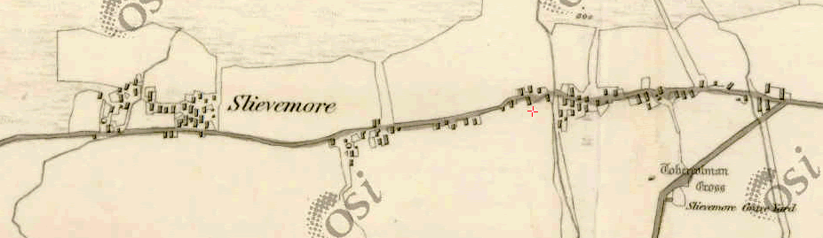
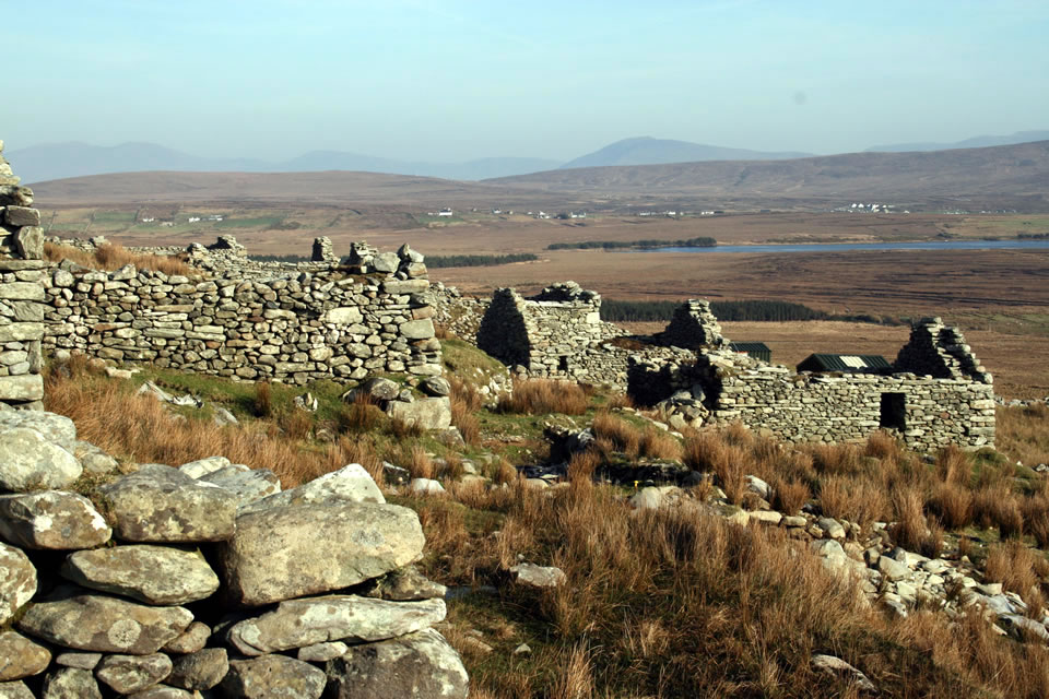
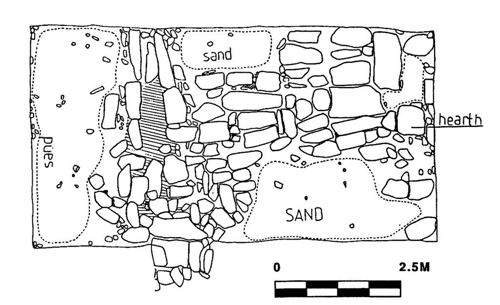
The ‘deserted’ village of Slievemore is one of the best known sites on Achill. The deserted settlement lies on the foothills of Mount Slievemore, straddling the 70 metre contour, and consists of three distinct groups of houses linked by a pathway. These three groups of houses are referred to as Tuar, Tuar Riabhac and Faiche, although the names are toponyms that post-date the abandonment of the settlement and refer to different types of grazing to be found amongst the ruins. In total, the village stretches from east to west for about 1.5km. In the first edition Ordinance Survey of 1838, 137 houses were recorded, of which traces of 74 houses can still be made out. The buildings are of dry stone construction and the walls often survive up to their original height. Over 90 per cent of the houses are aligned north-south, at right angles to the street. A majority of the houses at Slievemore were one-roomed cabins called byre houses, where livestock were kept at one end during the winter, separated from the humans at the other end by a small channel. This type of dwelling was the prototype of the classic three-roomed house that can still be seen in most Achill villages. Between 1991 and 2013 the AAFS excavated three houses in the village, House 36 (1991-2003), House 26 (2004-9) and House 6 (2013).
Read More:
- McDonald, T. 1990. Achill Island. Archaeology Ireland 4 (3), 7-9.
- McDonald, T. 1997. Achill Island – Archaeology, History and Folklore. I.A.S. Publications.
- McDonald, T. 1998. The Deserted Village, Slievemore, Achill Island, County Mayo, Ireland. International Journal of Historical Archaeology 2 (2), 73-112.
- McDonald, T. 2006. Continuity and Change on Achill Island. Archaeology Ireland, 20 (1), 17-21.
- Horning, A. 2007. Materiality and Mutable Landscapes: Rethinking Seasonality and Marginality in Rural Ireland. International Journal of Historical Archaeology, 11 (4), 358-378.
- Dunn, S. 2008. ‘Little more than a winter home’: An historical archaeology of Irish seasonal migration at Slievemore, Achill Island, Unpublished Ph.D. Thesis, Syracuse University, USA.
- McDonald, T. 2016. A Guide to the Archaeological and Historical Sites on Achill, Achillbeg and the Corraun Peninsula. I.A.S. Publications.
- McDonald, T. 2016. The ‘Ups and Downs’ of Booleying in Achill, Co. Mayo, Ireland. In Michael O’Connell, Fergus Kelly, James H. McAdam (eds.), Cattle in Ancient and Modern Ireland: Farming Practices, Environment and Economy, Cambridge Scholars.
Excavations Bulletins:
House 36
- Eoin Halpin & Theresa McDonald, Slievemore House 36, Excavations Bulletin 1991 Season
- Eoin Halpin & Theresa McDonald, Slievemore House 36, Excavations Bulletin 1992 Season
- Eoin Halpin & Theresa McDonald, Slievemore House 36, Excavations Bulletin 1993 Season
- Theresa McDonald, Slievemore House 36, Excavations Bulletin 1994 Season
- Theresa McDonald, Slievemore House 36, Excavations Bulletin 1995 Season
- Theresa McDonald, Slievemore House 36, Excavations Bulletin 1996 Season
- Theresa McDonald, Slievemore House 36, Excavations Bulletin 1997 Season
- Theresa McDonald, Slievemore House 36, Excavations Bulletin 1998 Season
- Theresa McDonald, Slievemore House 36, Excavations Bulletin 1999 Season
- Theresa McDonald, Slievemore House 36, Excavations Bulletin 2000 Season
- Theresa McDonald, Slievemore House 36, Excavations Bulletin 2001 Season
- Theresa McDonald, Slievemore House 36, Excavations Bulletin 2002 Season
- Theresa McDonald, Slievemore House 36, Excavations Bulletin 2003 Season
House 23
- Audrey Horning, Slievemore House 23, Excavations Bulletin 2004 Season
- Audrey Horning, Slievemore House 23, Excavations Bulletin 2005 Season
- Simon Ó Faoláin, Slievemore House 23, Excavations Bulletin 2006 Season
- Theresa McDonald and Nick Brannon, Slievemore House 23, Excavations Bulletin 2007 Season
- Stuart Rathbone, Slievemore House 23, Excavations Bulletin 2008 Season
- Stuart Rathbone, Slievemore House 23, Excavations Bulletin 2009 Season