Excavations at Slievemore Roundhouse 2 (2009-10)
Article © Copyright Achill Archaeological Field School
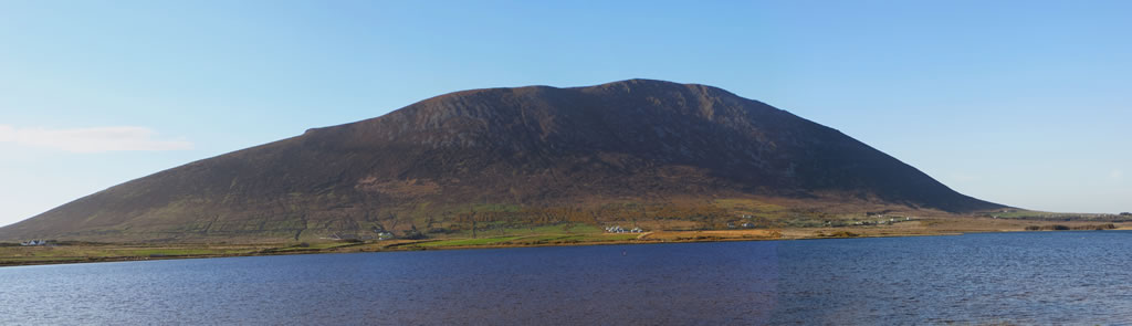
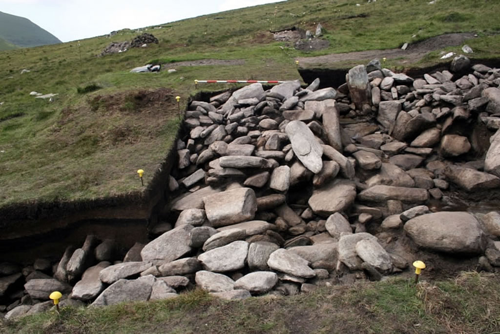
Roundhouse 2 is a large and complex building located on the Southern side of Slievemore approximately 50m east of the very similar Roundhouse 1 that was excavated between 2006 and 2008. Excavations by Achill Archaeological Field School began at Roundhouse 2 in 2009 when four trenches were excavated in a cross shaped pattern centred on the middle of the building. In 2010, excavations were continued at the site extending two of the previous year’s trenches and opening two new trenches to the west of the building. The building is circular in plan with an external diameter of 11m and an internal diameter of 6m. It is defined by a massive dry stone wall and has a long entrance passage at the southeast. The wall of the building is up to 2.3m wide and stands to a maximum height of 1.6m. It consists of neat courses of dry stonework retaining a rubble core, and has almost vertical wall faces.
The entrance to the building was located in the southeast and was investigated with a small trench in 2009 that was greatly expanded in 2010. The expanded trench revealed the true scale of the building, in particular the massive size of the walls and the full length of the entrance passage that runs through them. The entrance was lined by upright stone slabs along its north side but by neatly coursed dry stone walling along its southern side. In 2009, a crude upper level of pavement was recorded in the entrance and where a small piece of this was removed a much neater earlier pavement was observed, separated by a layer of soft sandy clay. In 2010, this early pavement was fully exposed throughout most of the entrance and was found to consist of large flat stone slabs sitting on a foundation layer of small rounded stones.
The building apparently sits at the junction between four field walls, which were only identified through excavation, suggesting that the complete field system is far more complex than is apparent from examining the walls that visibly protrude through the bog. To the south of the entrance a field wall was found to attach to the outer wall of the building, which had a width in excess of 2m. The junction between the wall and the building was very neat suggesting the wall and the building are closely contemporary. The line of this wall was subsequently traced for 58m out to the southeast.
To the north of the entrance several very large angular boulders were found lying on the surface of the mineral soil immediately outside the building. These are tentatively identified as part of a second field wall and bog probing suggests it continues for some distance to the north east of the building. However bog probing is difficult on Slievemore as the ground surface below the peat is highly irregular and contains large natural boulders and the existence of this field wall will only be confirmed through further excavation.
At the south of the structure another large field wall was found, running in a southwest direction from the southern edge of the building. This wall was quite unlike that found to the south of the entrance and consisted of a row of very large elongated boulders resting on top of a mass of medium sized stones. Clearly the wall was in a collapsed state but it is thought most likely the large boulders had originally stood upright on their short ends. The area where the field wall connected to the wall of the building was unfortunately just outside the eastern limit of the trench, although the way in which the collapsed wall rises up to meet the building suggests that the wall was built after the structure.
A fourth field wall was identified at the west of the building where it was visible in two of the four trenches dug in that area. The wall ran off to the north west and consisted of a row of medium and large boulders, and appeared similar to the field walls located to the north east of the entrance and attached to the south of the building, rather than the field wall discovered to the south of the entrance.
Inside the building it was discovered that three phases of occupation were present. The first occupation phase was represented by two large postholes located close to the wall at the northeast and south west of the building. These were clearly large structural posts and would have been part of a ring of upright timbers that supported the roof.
The second occupation phase was represented by a layer of soft sandy clay around 7cm thick that had been deposited across the whole interior and which was recognised as the same layer that separated the two layers of paving in the entrance. A number of internal features were cut through this layer including a centrally located hearth, numerous small postholes and a slightly irregular gully that surrounded the hearth and seemed to have been used to separate the central area of the building from the peripheral areas. The third phase of occupation was represented by a layer of buried turf, rich in charcoal and which had clearly developed after the building had lost its roof and had begun to collapse. A very similar layer of post-abandonment turf was observed within Roundhouse 1 and it is believed in both cases the roofless buildings were visited for a period after their occupation and fires were lit within them. This third phase of activity ended when peat began to form within the collapsing buildings interior.
Environmental samples taken from the central hearth were processed and charcoal was identified from seven different deciduous species indicating the presence of healthy deciduous woodland in the locality. Carbonised pieces of ling heather from the same sample indicate bog land was also present, possibly on the higher parts of the mountain. A radiocarbon date of 1431-1314 BC was obtained from a sample of burnt heather from the hearth, indicating that the second phase of occupation dates from the Middle Bronze Age, and that it was contemporary with the occupation of Roundhouse 1. As with the excavations at Roundhouse 1 artefacts were limited to a small number of pieces of flint and a large assemblage of fragmented quartz pieces that are currently being analysed.
Read more:
- Rathbone, S. 2011. The Slievemore Roundhouses. Archaeology Ireland 25 (1), 31-35.
- McDonald, T. 2016. A Guide to the Archaeological and Historical Sites on Achill, Achillbeg and the Corraun Peninsula. I.A.S. Publications.
Excavations Bulletins: