Excavations at Slievemore Roundhouse 1 (2006-08)
Article © Copyright Achill Archaeological Field School

In 2006 work began on a small scale at one of the roundhouse sites on Slievemore, located higher up the slope above the Deserted Village. A number of small test pits were excavated that year were to assess the results of a post-graduate student’s research project that was attempting to identify use patterns inside the buildings through differences in soil phosphate levels. These trenches were located in order to provide a context for the changes in phosphate levels that were recorded from the surface samples, with one trench being placed in the centre of the building, a second placed over a possible Midden area immediately outside the building and a third over an area of low phosphate levels thought to be an area of undisturbed ground at a further distance from the building. As part of this project the first radiocarbon date for the buildings was obtained, from a sample of what turned out to be a layer of post abandonment soil. The sample returned a date of 1411-1210 BC, suggesting the building had been in use during the Middle Bronze Age. The early date provided a compelling reason to return to the site and investigate it in more detail.
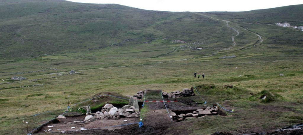
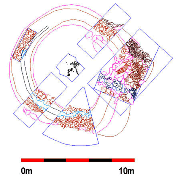
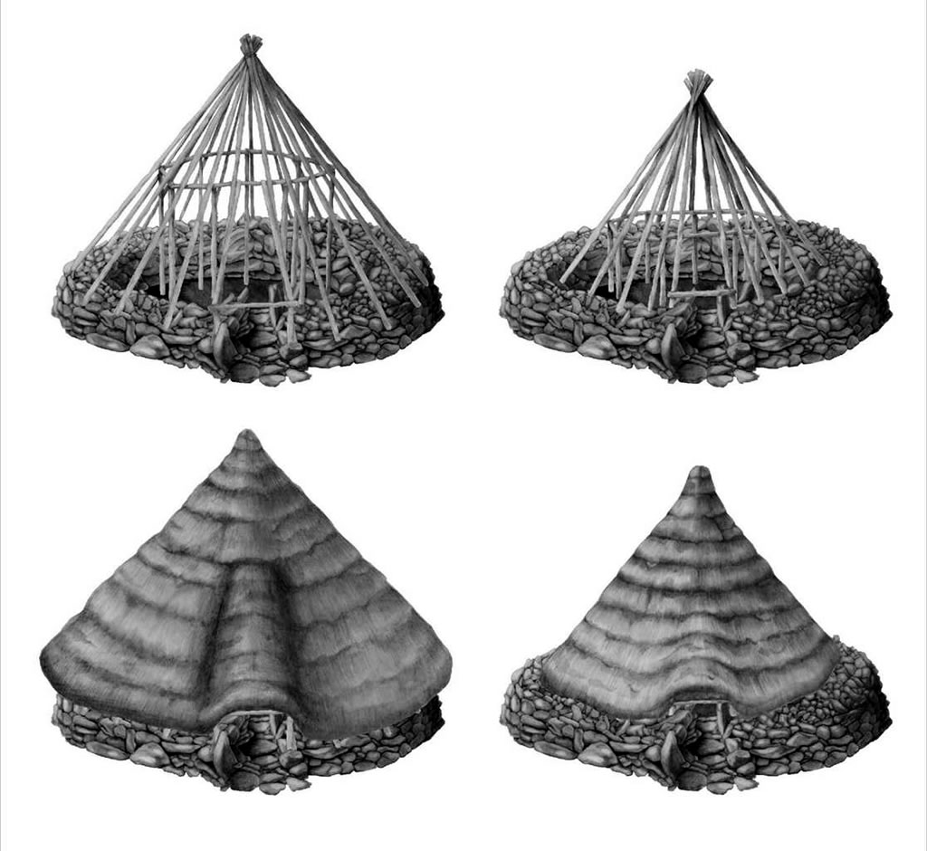
Over the following two seasons a total of six trenches were excavated across the site and a complicated and monumentally proportioned structure was revealed. The structure is roughly circular in plan with an external diameter of c. 11m. It is defined by a substantial stone wall and has an entrance at the southeast. The southern arc of the wall is particularly complicated and consists of numerous components. The wall in that area was up to 1.7m tall and up to 2.2m wide. A vertically sided, flat-bottomed slot ran through the middle of the wall, which was 0.5m wide and 0.7m deep and it is believed to have acted to drain water away from the sloping roof. A small exploratory trench was placed over the wall at the west of the structure where there was a suggestion that an entrance may have been located. This trench did not reveal the full width of the wall but showed that the possible entrance was a secondary feature relating to the re-use of the structure as an animal pen in the early modern period.

A trench in the centre of the structure revealed a deep build-up of peat within the interior overlying a thin buried turf layer, complete with preserved grass and much charcoal, the layer from which the initial radiocarbon date was recovered. Underneath this turf a series of internal features were discovered including a central a hearth, two adjacent post-holes and a series of small stake-holes. A sample from this hearth was radiocarbon dated to between 1296 and 1115 BC, confirming a Middle Bronze Age date for the occupation.
The structure had a complicated entrance located at the southeast consisting of an elongated passage, with a stone-lined base and large stone slabs flanking the sides. A pair of pillar-like orthostats were present at each end of the entrance, with the western, inner pair being slightly taller than the eastern, outer pair. A sill stone ran between the two stones of the outer, eastern pair of orthostats. Interestingly, the entrance feature extended beyond the inner edge of the wall into the building’s interior band so the inner pair of orthostats were actually internal features.
Despite the exceptional preservation of the building the artefact assemblage from the structure was severely limited, consisting of only a fragment of a flint plano-convex knife, a small flint scraper, a fragment of a chert blade and a few pieces of flint debitage. No bones, animal or otherwise, were recovered from the site due to the highly acidic nature of the soil.

Read More:
- Rathbone, S. 2010. Excavating a Roundhouse. Past Horizons.
- Rathbone, S. 2011. The Slievemore Roundhouses. Archaeology Ireland 25 (1), 31-35.
- McDonald, T. 2016. A Guide to the Archaeological and Historical Sites on Achill, Achillbeg and the Corraun Peninsula. I.A.S. Publications.
Excavations Bulletins: