Archaeological Research & Excavations at Keem Bay, Achill Island (2009-18).
This article is © Copyright Achill Archaeological Field School
The Keem Bay Project (2009–2018) is an AAFS research strand focused on the fascinating post-medieval settlement at Keem Bay Achill Island. The project is making important contributions to our understanding of household and material culture in pre-Famine Mayo, as well as to the dating and character of rundale settlement in Ireland.
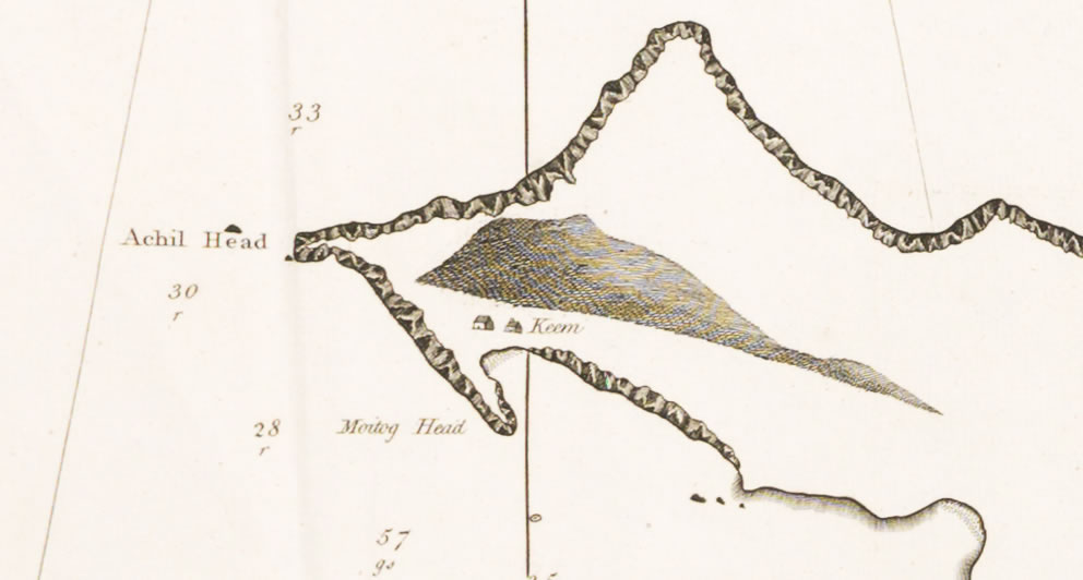
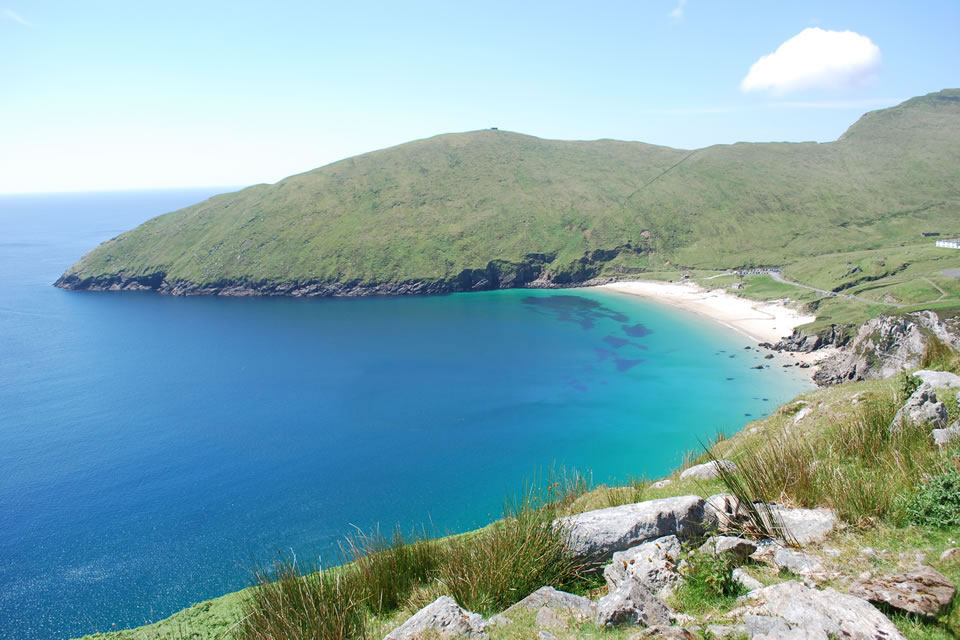
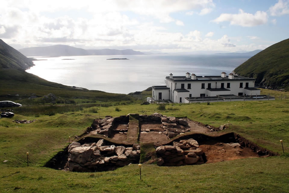
Keem is a sheltered valley on the western-most tip of Achill Island. The first-edition OS map (1838) shows a substantial clustered settlement of 40 buildings in the valley, surrounded by a large area of enclosed cultivation ridges. Ethnographic and historical evidence suggests that Keem was a seasonally occupied settlement associated with transhumance, although the archaeological evidence is not so clear. Writing in 1839 Ceasar Otway, a Protestant clergyman from Tipperary noted that Keem was:
only inhabited in summer … the owners of the village ... have other houses in a distant part of the island, where they spend the winter and spring; thence they come when their oats and potatoes are planted and spend the summer months, herding their cattle on these heights, and leading a pastoral life
Ceasar Otway (1839)
This assertion was echoed by later ethnographic work undertaken by O’Kelly in the 1940s, who reported that Keem was a booley settlement used by the people of Slievemore (O Moghrain and O Duilearga 1943, 169).
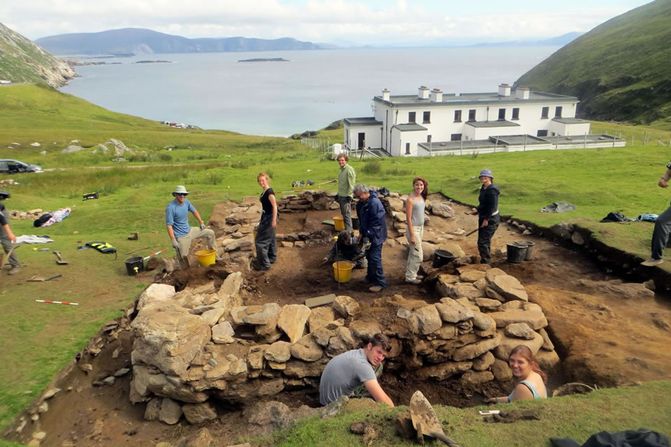
Prior to the excavation one of the big questions about the settlement at Keem Bay regarded how it should be interpreted, as the remains of a small permanently occupied village or as a large transhumant seasonally occupied booley village. The excavations at Building 3 have provided important information that relates to that question. Building 3 appears to be a permanently occupied dwelling, that conforms to descriptions of early 19th-century houses on Achill, and crucially the division of the building into a byre dwelling arrangement is not what would be expected from a house only occupied during the summer months when animals could happily be kept outside.
2016 Season
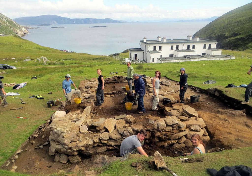
In 2016 work continued at Keem with the excavation of Building 4, a mounded footprint located immediately SW of Building 3. Both buildings were orientated on the same NW-SE axis. Building 4 was an oblong structure defined by thick earth and sod walls revetted by dry-stone facing on the interior and exterior. It was 2.5m wide by 4.8m long internally. It had straight walls with noticeably rounded corners, both inside and out. The building had a diagonal drain that ran N-S across its NW end and exited at the door, in the SW wall of the building. Most interesting the building had not one, but three hearths, that seem to have been used sequentially. This is perhaps the most significant finding from Building 4 and it suggests that the dwelling was occupied episodically. The artefacts from the building indicate a late 18th to early-19th century date, similar to Building 3.
2017 Season
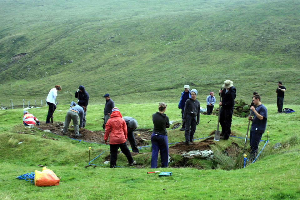
During the 2017 season, a programme of surveying was undertaken and two cuttings were excavated at Keem. The survey focused on a previously unrecorded cluster of building footprints flanking the eastern bank of Abhainn na hUachtaí (a stream in the valley), which the author suggests may relate to an early booley phase at the settlement. The two cuttings were chosen to address specific questions about the settlement relating to the form of the buildings, and the character and chronology of the settlement.
The first cutting investigated Building 5, a small rectangular dry stone structure (2.5m by c. 5m) that appears to overlie the other building footprints. Both oral history and historical sources indicate that Keem may have been re-used for seasonal grazing in the late 19th or early 20th century. It is argued that Building 5 represents such a later hut. The aim of the trench at Building 5 was to test this theory. The second cutting investigated Building 2, a small footprint located east of Building 3. The excavations aimed to clarify the morphology of the building and to investigate the material culture associated with the structure.
The small trench over Building 5 succeeded in revealing its form and shedding light on its date. The trench showed the building to be a small roughly-built dry stone and sod structure. It clarified the overall plan of the building, indicating a bi-partite plan, with a north-west and a south-east chamber. The south-east chamber measures c. 2m long by 1.5m wide internally with a narrow door in the south-east end of its south-west wall. An additional chamber is attached to the north-west end of the structure and it measures c. 2.8m by 2m externally. This second chamber has bedrock elements in its north-east and north-west walls. The relationship between the two chambers is not completely clear and excavation is required for full resolution of the building. The north-west chamber may be a second hut or it may be a storage annexe, perhaps for milk.
The excavation of Building 2 succeeded in clarifying its morphology and provided good dating evidence in the form of ceramics. Building 2 was revealed to be a single-room oblong structure with thick earth and dry-stone walls (0.9-1.3m wide). It had very rounded corners on the exterior and slightly rounded corners on the interior. It measured an estimated 7.8m by 4.7m externally and 5.4m by 2.5m internally. It had a single doorway in the south-east end of its south-west wall. The building had a single stone-lined hearth in its long north-east wall, and it had a cross-drain exiting through the doorway. The assemblage from the site included early 19th-century refined earthenware, coarse earthenware, bottle glass, copper alloy, iron, amethyst and stone artefacts.
Read more:
- Campbell, E. 2016. Mysteries of Deserted Pre-Famine Village on Achill Island Revealed. Irish Central.
- McDonald, T. 2016. A Guide to the Archaeological and Historical Sites on Achill, Achillbeg and the Corraun Peninsula. I.A.S. Publications.
Excavations Bulletins: