Excavations at the ‘Cromlech Tumulus’ on Slievemore Mountain 2014–2017
Middle Bronze Age roundhouse, fulacht fia, later medieval hut, post-medieval huts and Neolithic knapping area.
© Copyright Achill Archaeological Field School.
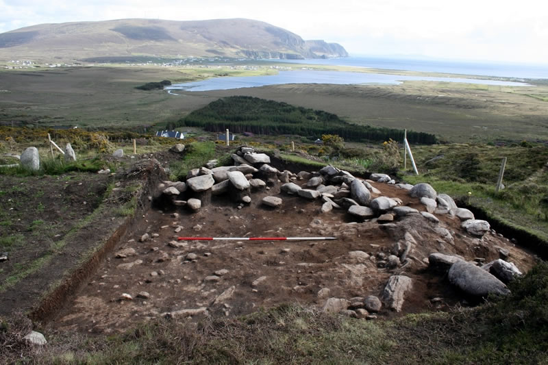
In 2014 work began at a very intriguing site on Slievemore known as the ‘Cromlech Tumulus’. The site was originally recorded in the 19th century, first by the Ordnance Survey and later by W.G. Wood Martin, the famous Sligo Antiquarian. It has caused considerable debate throughout the 20th century as different archaeologists tried their best to interpret the confusing remains visible at the site. Wood Martin thought it was part of a complex “sepulchral group” and clearly felt it was a megalithic site of some sort. Thomas Westropp thought it was an ancient multiple hut site, an opinion shared by Michael O’Kelly. Stuart Piggott and Thomas Powell thought it was a megalithic tomb with perhaps some later interference whilst Ruaidhrí de Valéra and Seán Ó Nualláin thought the site was best regarded as “one or more houses with lamb shelters built into the eastern end” with a possible hut or kiln at the west, and imply a recent origin. The Sites and Monuments Record currently lists the site as a possible megalithic structure.
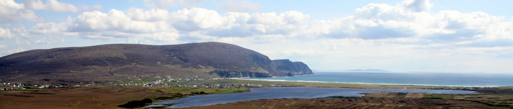
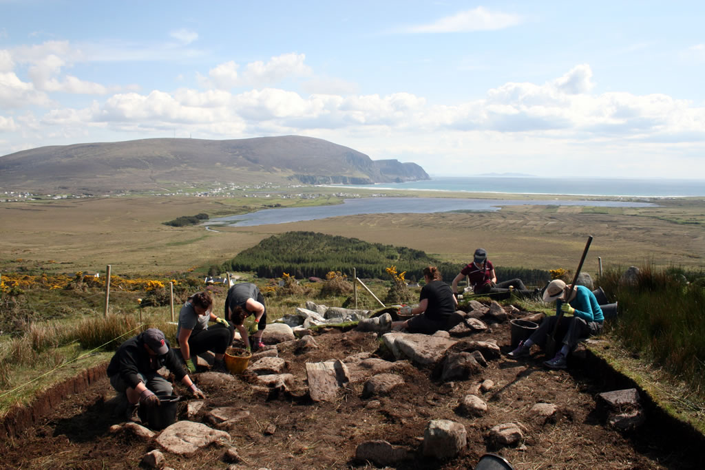
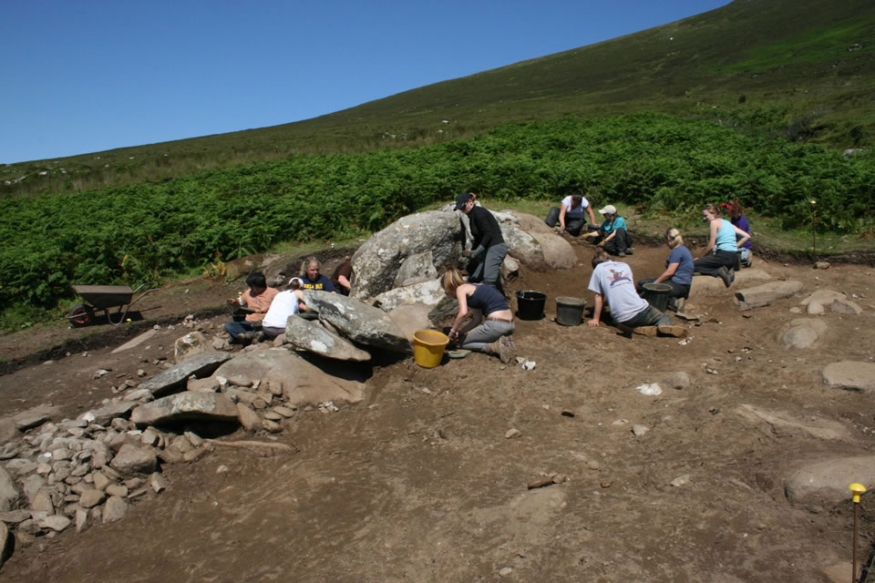
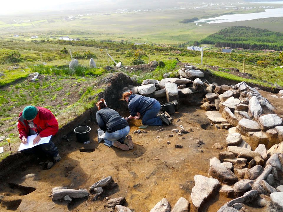
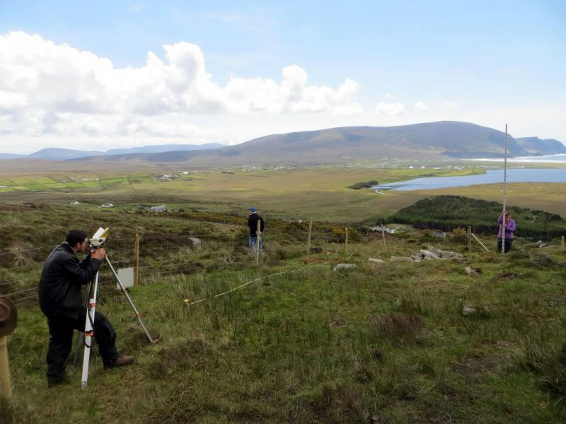
Work began at the site with an intensive survey, using high precision GPS units to produce the first accurate plan of the site and a manual survey with a 50cm resolution allowed for the production of an accurate 3D topographic model of the sites form prior to excavation. In 2014 three large trenches were excavated over the western half of the site and during the first half of the 2015 season a fourth trench was excavated to complete work on the western half of the site. We will return to the site during the first half of the summer of 2016 to begin work on the eastern part of the site.
The western part of the site contains two main phases of activity. The initial period of activity at the site revolved around the construction and prolonged occupation of a large oval shaped building during the Middle Bronze Age period. The building is similar in size to the Middle Bronze Age <a href=”/research-excavations/roundhouse-1/”>Roundhouse 1 </a>and <a href=”/research-excavations/slievemore-roundhouse-2/”>Roundhouse 2</a> that Achill Field School had previously excavated on Slievemore, which are located almost 2km to the west. However there are some important differences between this building and the two Roundhouses. Firstly the construction of the perimeter wall is quite different, the use of stone facing to retain a thick core of earth is quite different to the regularly coursed dry stone walls utilised at the Roundhouses. Secondly the entrance is located at the south south-east of the building, rather than at the east south east, and instead of it being a long stone lined passage it appears to be a simple gap in the wall flanked by two large orthostats. It is worth noting that although the overall layout is different the entrance passage of Roundhouse 1 also terminated at two large orthostats.
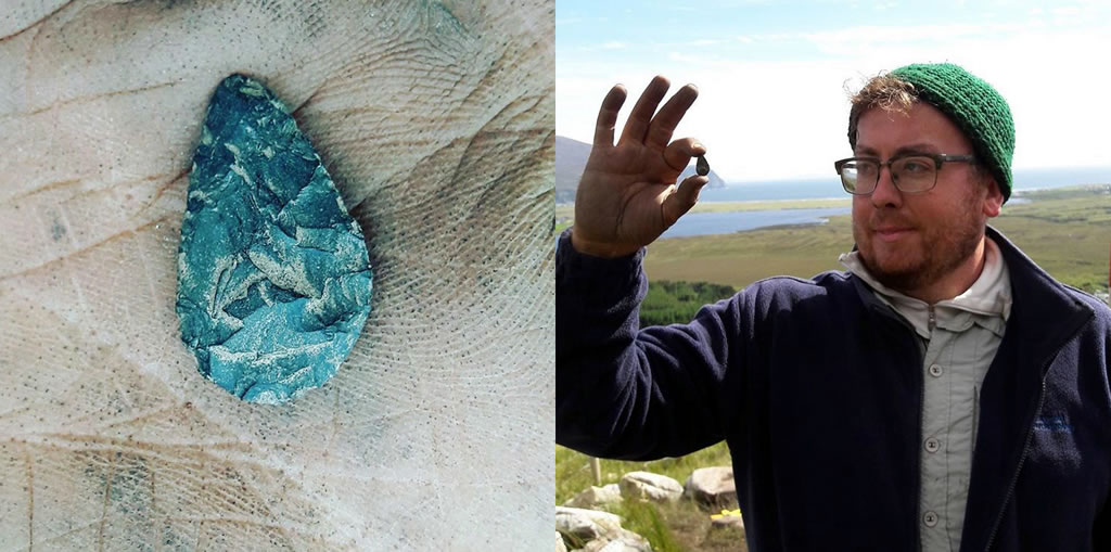
The third major difference is that the interior of the building contained a tremendous number of pits and postholes. Whilst the interior areas of Roundhouses 1 and 2 both contained pits and postholes they were not in the profusion found at this site. At the very least this strongly suggests a longer and more complicated period of occupation, but it may potentially also relate to a difference in function. Finally whilst the finds assemblage from the Roundhouses and this building at the Cromlech Tumulus site are largely similar, consisting mainly of small lithic flakes, diminutive lithic tools, hammerstones and rounded pebbles of currently unknown purpose, the building at the Cromlech Tumulus site also produced two sherds of Bronze Age pottery and a unique sculpture of a head carved out of a small pebble. Again it is not clear whether this relates to a functional difference or simply that there was a longer period of occupation that led to more occasions for artefacts to be deposited in recoverable contexts.
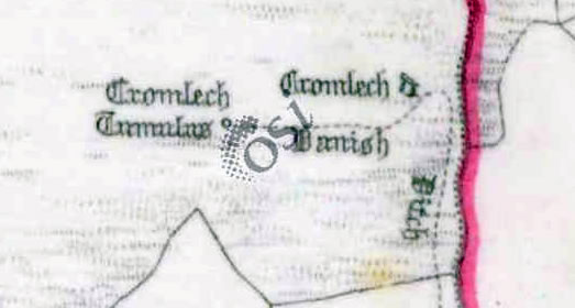
A pre-bog field wall identified as ‘the Danish Ditch’ on the early Ordnance Survey maps links this site to a Neolithic Court Tomb located about 130m to the east. We have examined two sections of this wall in small additional trenches located 30m and 60m east of the main excavation. We suspect this is part of a Bronze Age field system surrounding the site, but its date has not yet been firmly established. The wall seems to connect to the southeastern side of the Middle Bronze Age building but this has yet to be confirmed through excavation. A second field wall was discovered during the excavation of the northwestern part of the site in 2015. This wall actually seems to overlay the edge of the Middle Bronze Age building, which suggests it was built sometime after it, although it may have been constructed whilst the building was still in use.
The second phase of the activity at the sites relates to a pair of small huts that were built over the ruins of the large Middle Bronze Age building. The earlier of these structures was a small oval building defined by a simple stone foundation, which reused the pair of orthostats from the underlying building as its entrance. The building measured 6.1m E-W and 3.6m N-S externally. A series of three overlying hearths were found in the centre of this small structure and a Radiocarbon date of 1435 -1618 AD was obtained from the middle hearth in the sequence. This date spans the Late Medieval period and the very start of the Post Medieval period which is a very interesting result given the general dearth of low status rural buildings known from this period in Ireland.
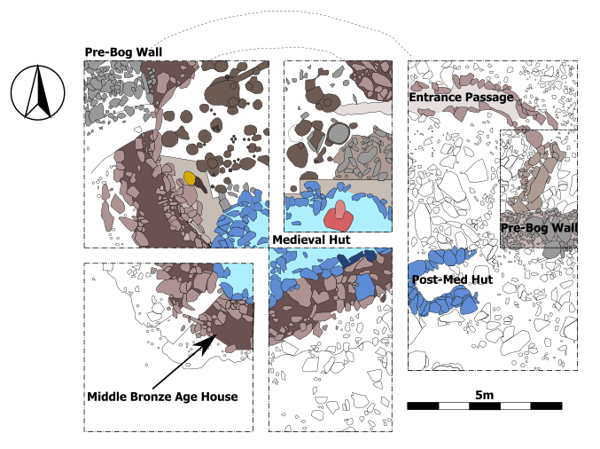
Additionally Achill Archaeological Field School has already recorded two similar buildings elsewhere on Slievemore, which whilst currently undated overlay well-dated Early Medieval buildings and so potentially these may be of a similar date to the structure at the Cromlech Tumulus. The function of this small oval building is difficult to ascertain but certainly it would conform to the size range expected from transhumant seasonally occupied Booley Houses, and this is an exciting possibility we are currently exploring. The oval building was in turn overlain by a smaller circular building, defined by a simple turf bank that must surely date to the Post Medieval period. This building had an external diameter of just 2.85m and certainly could not have been any sort of full time residence. Whether it represents a much smaller Booley house, an emergency shelter or some sort of agricultural structure has yet to be determined, but this is a subject that we are actively investigating at present.
In 2016 we returned to the Cromlech to excavate an additional trench on the eastern side of the monument. An elaborate curving entrance to the building was found on the north side of the trench. More evidence for the later use of the site was revealed in the presence of a small corbelled hut of probable medieval or post-medieval date. Some of the most exciting material from our 2016 season at Slievemore came from excavations at the Danish Ditch. The trenches at the site uncovered what seems to be a terraced road running along the 110m contour.
Fulacht Fia
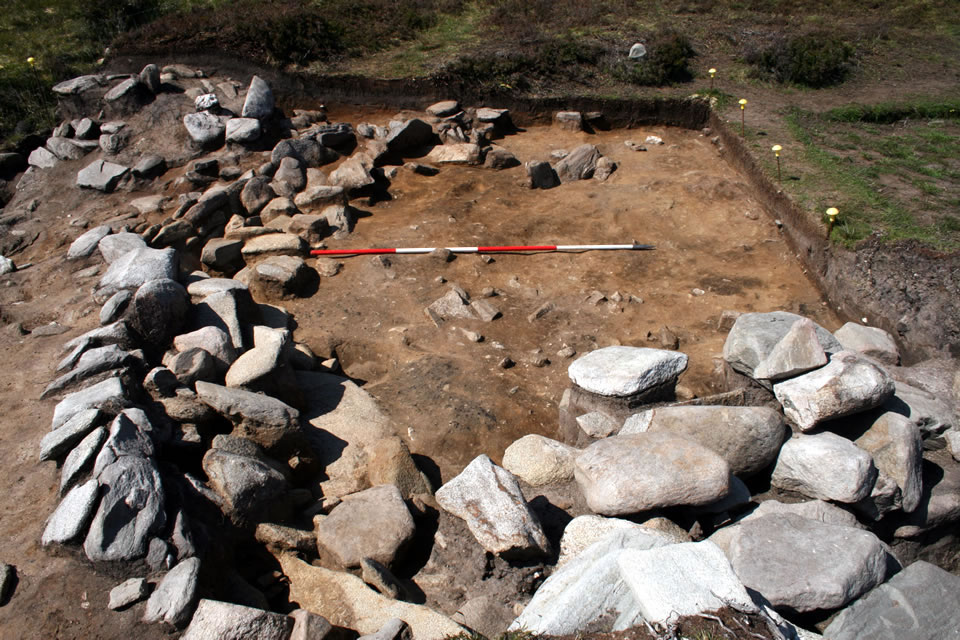
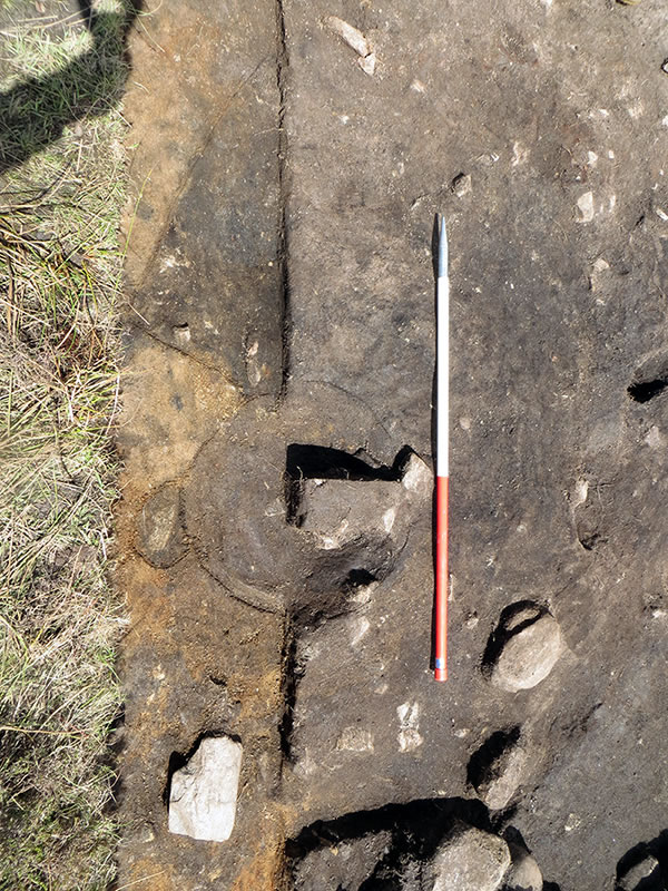
In 2017 Quadrant 5 was reopened in a bid to fully resolve the area. Work began by excavating the overlying layer of soil and stone rubble concealing the structural remains. Once this was removed the curving eastern wall of the MBA structure became visible along the western side of the trench. The wall was composed of a bank of earth and stone. It soon became apparent that what Rathbone had identified as the MBA building’s ‘entrance passage’ and the ‘small circular building’ were both structural elements of a stone-lined fulacht fia. The feature comprised a stone-lined trough orientated north-west/south-east and measuring 1.8m long by c. 1m wide and 0.45m deep. It was built in the corner between the junction of the eastern wall of the MBA building and the pre-bog field wall, and thus post-dates both features. A stone ledge or platform flanked the southern side of the trough and the entire feature was surrounded by a low stone wall/kerb of variable height. This wall or kerb served as a revetment for the burnt mound that formed part of the fulacht fia. The mound arced around the trough and was most pronounced on its northern and eastern sides. To the south the burnt mound respected the earlier pre-bog field wall. It comprised a deposit of heat-shattered and degraded stone mixed with charcoal and silty sediment up to 0.5m deep. Significant quantities of water-rolled beach cobbles were present in the deposit; most of these were pink sandstone ultimately derived from the Corraun Peninsula. No bone was found in the burnt mound, but a deposit of ceramics thought to represent a single coarse Bronze Age vessel was found in the deposit to the north of the trough. After the final use of the fulacht fia it was deliberately filled in with large stones and the trough was paved with rough slabs to create a level surface. A large sherd of coarse prehistoric pottery found above this layer indicates that this ‘closing’ of the monument occurred in antiquity.
Lithics Scatter
A sondage through the burnt mound in the north-east corner of the trench showed that it overlay a layer containing dense concentrations of worked chert, flint and quartz, with occasional sherds of prehistoric pottery, and moderate concentrations of charcoal. This layer was found to extend along the entire eastern edge of the trench at its lowest levels. A line of four stake-holes were associated with this layer in the southern half of the trench. The dense concentration of lithics, including chips of debitage and partially worked beach-rolled flints suggest that this may constitute a knapping area. A small chert leaf-shaped arrow head and a chert hollow scraper retrieved from this layer suggest a Neolithic date.
Other notable finds from the 2017 season include a stone spindle whorl recovered from the upper layers in the southern half of the site.
The ‘Danish Ditch’
During the last two weeks of the excavation a 12m by 2m trench was excavated across the path of the ‘Danish Ditch’, the pre-bog field wall running between the MBA building and a nearby Neolithic court tomb. This was the fourth slot trench excavated over the features since we began our project here in 2014. Previous work has tracked the path of the monument and our 2016 trench was especially significant, revealing that the feature comprises a pair of parallel banks. Our 2017 trench was empty, despite being carefully lined up with the known line of the monument. While analysis is ongoing it seems that it may have been robbed out in antiquity–perhaps related to the construction of the fulacht fia.
Read More:
- Rathbone, S. 2015. A Middle Bronze Age stone head from Slievemore, Achill Island, Co Mayo. Past: The Newsletter of the Prehistoric Society 81, 15-16.
- Rathbone S. and McDonald, T. 2014. The Cromlech Tumulus at Keel East Townland. Past Horizons.
- Rathbone, S. and McDonald, T. 2015. Excavating the Cromlech Tumulus on Slievemore: The Story So Far. Past Horizons.
- ‘Excavation unearths Bronze Age artefact’, Connaught Telegraph, 9 July 2015.
- McDonald, T. 2016. A Guide to the Archaeological and Historical Sites on Achill, Achillbeg and the Corraun Peninsula. I.A.S. Publications.
Excavations Bulletins: